
")


")
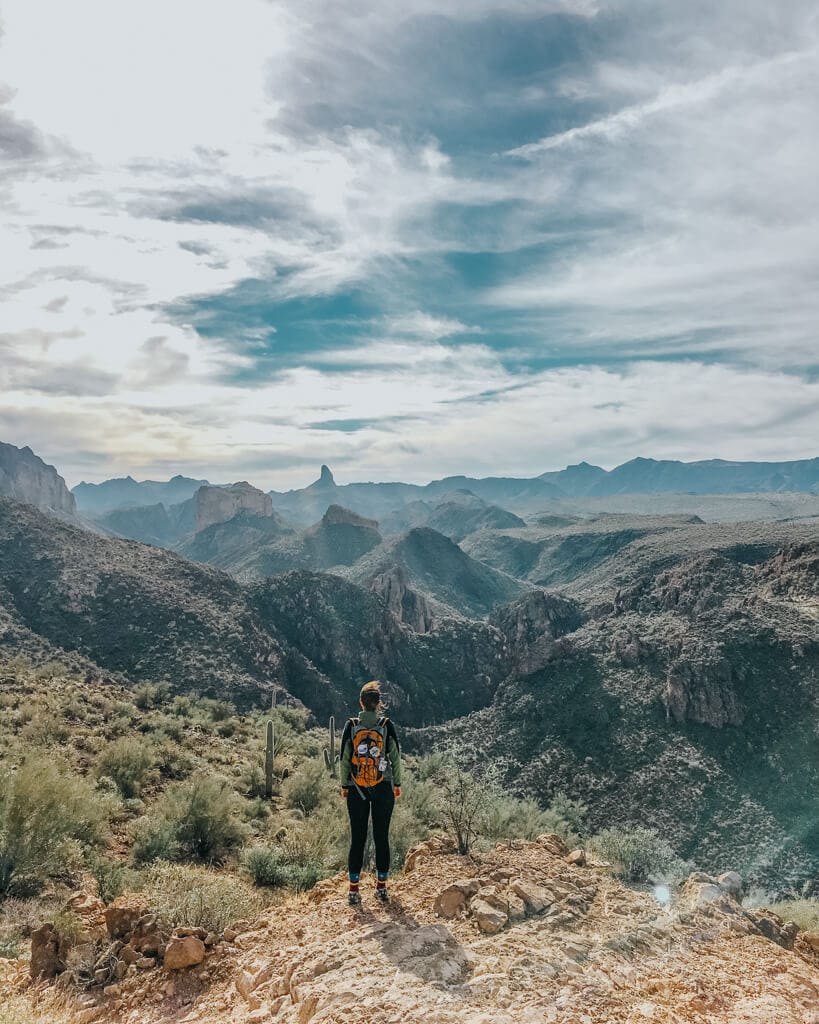
Arizona’s Superstition Mountains are a haven for outdoor enthusiasts, offering awe-inspiring landscapes, unrivaled natural beauty, and a wealth of history and folklore. The best part? They’re in the Phoenix area so you don’t have to go too far to enjoy these! In this all-encompassing guide, we’ll uncover the best hikes in the Superstition Mountains, AZ, guiding you on an unforgettable journey through the heart of the Southwest.
As a local to Arizona for over 17 years, I’ve been hiked through the Superstition Mountains for most of my life. So I am using my experience to tell you which Super hikes are 100% worth a spot on your bucket list.
Lace up your boots, grab your camera, and prepare to discover the hidden gems nestled within the remarkable Superstition Mountains!
📌 Save this to Pinterest!

🥾Pro Tip: You’ll need sturdy hiking boots for these trails!
List of the Best Hikes in the Superstition Mountains
- Lost Dutchman Treasure Loop Trail
- Flatiron via Siphon Draw Trail
- Wave Cave
- Treasure Trail and Siphon Draw Loop
- Boulder Canyon Trail
- Hieroglyphic Trail
- Weaver’s Needle Loop
- Fremont Saddle Peralta Canyon Trail
- Battleship Mountain Scramble
- Garden Valley Loop
- Carney Springs Waterfall via Lost Goldmine Trail
- Massacre Falls Trail
- Broadway Cave via Jacob’s Trail
- Picketpost Mountain Trail
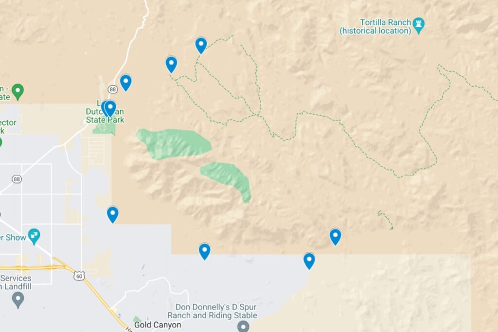
Below, we’ll dive into each of these trails and what you can expect. Here is where you can find a map with all the trailheads.
Click here for a live version of the map!
🥾Don’t Forget: You’ll need sturdy hiking boots for these trails!
All The Best Hikes in the Superstition Mountains
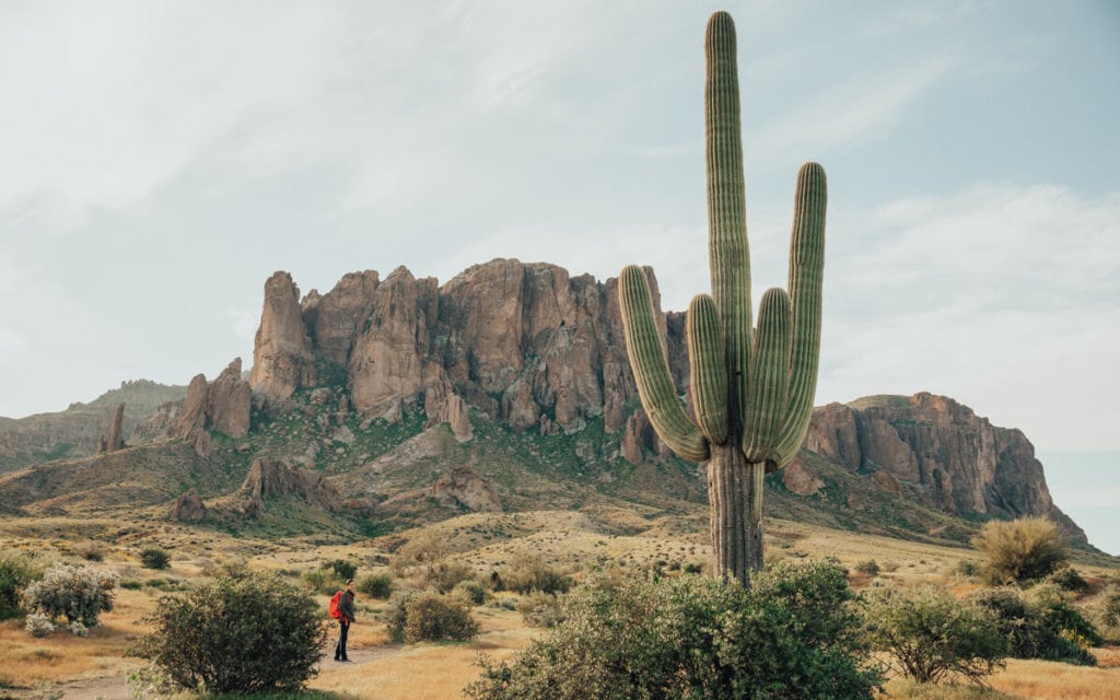
#1 Lost Dutchman Treasure Loop Trail
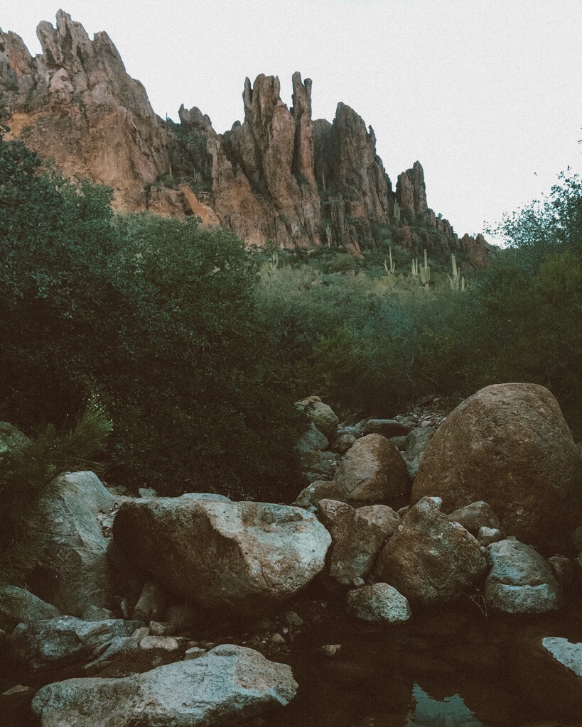
Okay, when I think of Superstitions, I think of Lost Dutchman State Park. It’s easily one of the most beautiful state parks in Arizona. And if I only had time for one hike here, it’d be this one: Treasure Loop. The Lost Dutchman Treasure Loop Trail, from my experience, is easy to moderate. The 2.3-mile loop trail takes you right around the base of that mountain you see in the pics, Flatiron!
- Trailhead: 33.4576573,-111.4788824
- Mileage: 2.3 miles round trip
- Difficulty: Moderate
- Elevation gain: 534 feet
- Parking permit: Required

Beginning at the Lost Dutchman State Park, the trail meanders through the park’s picturesque desert landscape, cactus and all! As you ascend, you’ll be treated to increasingly impressive views of the surrounding Superstition Mountains, including the iconic Flatiron and Weaver’s Needle (we’ll cover this hike too).
The trail reaches its highest point at the junction of the Treasure Loop and Prospector’s View trails. Here, you can take a moment to rest and soak in the stunning panoramas before descending back to the trailhead.
Seriously, come here for sunset! You don’t even have to hike the entire loop, especially if you’re on a longer venture like an Arizona National Parks road trip!
Fun fact, this area has a pretty spooky history that includes hidden treasure among other things — ooooooo. Before you go, make sure you read about the fees here.
Pro Tip: Come here during sunset for the best light— bring your Sony a6400!
#2 Flatiron via Siphon Draw Trail
For all you challenge seekers out there, meet your perfect match. Hiking Flatiron via Siphon Draw offers 360 views and a thrilling climb through diverse landscapes. This difficult 5.5-mile round trip hike features a significant elevation gain of 2,641 feet, making it suitable for experienced hikers. Would you believe me if I said this was one of the first hikes I did in Arizona? HAHAHA. Probably wouldn’t do this one in tennis shoes.
- Trailhead: 33.4593348,-111.4799342
- Mileage: 5.5 miles round trip
- Difficulty: Strenuous
- Elevation gain: 2,641 feet
- Parking permit: Required

From experience, this hike can be pretty difficult to navigate in some areas. It’s best to start your hike in the morning and have a trail map downloaded!
Starting at the Lost Dutchman State Park (fee required), the trail begins with a gentle wander through the desert landscape before leading to the mountain’s base. As you progress, the trail steepens, requiring careful navigation of rocky terrain and steep scrambles!
In other words, you will do a bit of climbing since you’re practically going straight up the mountain.
There will be some areas where you may lose your footing — follow the trail markers to stay safe.
The final push to the summit is challenging but rewarding, with views of the surrounding desert and Phoenix in the distance! On another note, it can get a bit crowded so I recommend getting here early.
Pro Tip: Make sure you have sturdy hiking boots!
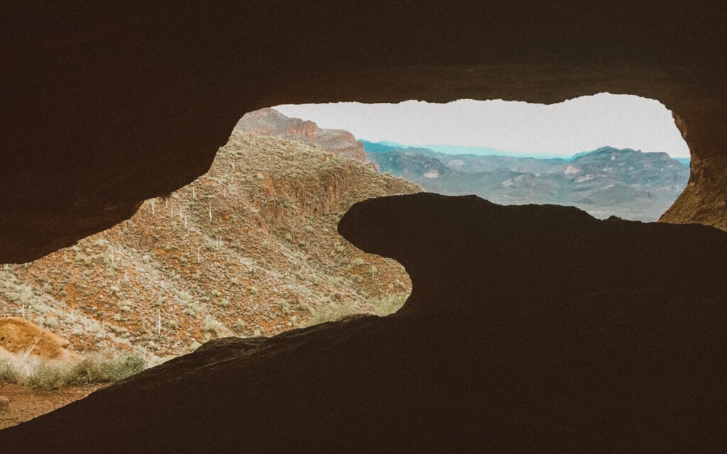
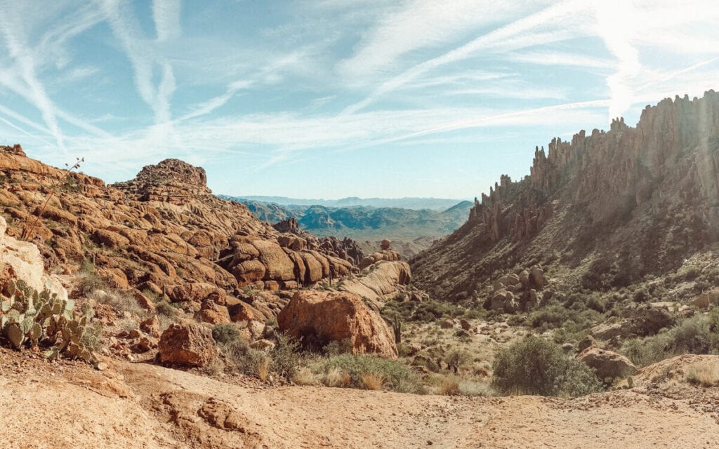
#3 Wave Cave (Unique Hike in the Superstition Mountains)
Wave Cave is a local’s favorite and probably one of the most unique hikes in the area. It was also one of the first hikes I ever did in Arizona! A short, steep climb takes you up to this unique wave formation where you can take a gazillion cheesy pictures of you surfing LOL. The surrounding views are great, too. There are so many cave hikes in AZ, but this has to be the one I recommend most often.
- Trailhead: 33.3856578,-111.373334
- Mileage: 3 miles round trip
- Difficulty: Moderate
- Elevation gain: 869 feet
- Parking permit: None
The hike begins at the Carney Springs Trailhead, leading you through a picturesque desert landscape filled with saguaros. As you progress along the trail, take time to enjoy the views of the Superstition Mountains!
The trail gradually ascends, becoming steeper and rockier as you approach the Wave Cave. And I have to warn you, this trail gets STEEP in some places, making it a literal stair-master. If you’re weak on the knees have some trekking poles!
You’ll continue your steep climb until you reach the base of the cave. Getting inside is pretty easy as it has been traversed so much over the years.
Once inside the Wave Cave, climb on that wave and snap some pics!
The Wave Cave is a great option if you’re spending a weekend in Scottsdale or just visiting the area!
Read Next: Phoenix versus Scottsdale
#4 Treasure Trail and Siphon Draw Loop
If you want to do a combo of two of the best hikes in the Superstition Mountains, try the Treasure Trail and Siphon Draw Loop! You’ll go up to a vantage point that sits above Treasure Loop, which is a great place to watch the sunset. The hike is considered moderately challenging and rocky, so wear sturdy hiking boots.
- Trailhead: 33.4576573,-111.4788824
- Mileage: 3 miles round trip
- Difficulty: Moderate to difficult
- Elevation gain: 564 feet
- Parking permit: Required
Beginning at the Lost Dutchman State Park, the trail meanders through the desert before reaching the base of the mountains. You’ll continue to loop around, getting a bit of both trails in the loop.
You can do the loop clockwise or counterclockwise. From experience, you can’t go wrong with either.
Because this hike is in Lost Dutchman State Park, you will be required to pay upon entrance. This trail also has no shade, so wear a hat.
This hike is great if you’re living in the area, however, if this is your first time visiting AZ and you don’t have too much time to explore, consider others I’ve listed.
Read Next: Best Sunset and Sunrise Hikes in Arizona
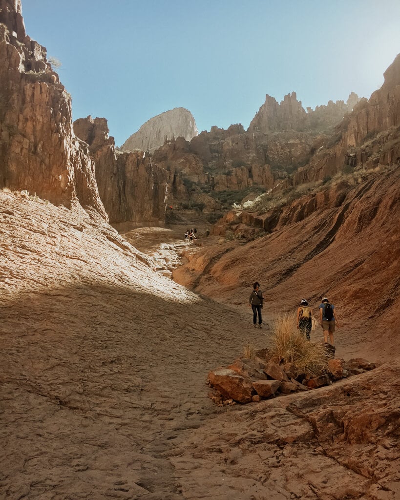
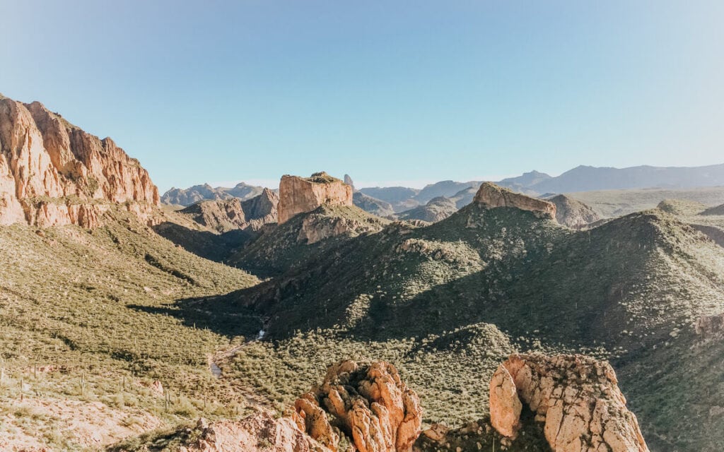
#5 Boulder Canyon Trail Hike in the Superstition Mountains
I LOVE Boulder Canyon and once you’re at the vista pictured above, it’s easy to see why! Boulder Canyon Trail is an exceptional and moderately challenging hike in the Superstition Mountains, ideal for experienced hikers seeking an exhilarating adventure. This 10-mile round-trip trail takes you through a breathtaking desert landscape, culminating in a stunning viewpoint overlooking the Superstition Wilderness.
- Trailhead: 33.534016,-111.4330508
- Mileage: 10 miles round trip
- Difficulty: Moderate to difficult
- Elevation gain: 1,965 feet
- Parking permit: Required
Starting at the Canyon Lake Marina Trailhead, the trail leads you through a picturesque desert environment filled with saguaros, ocotillos, and a variety of desert flora. As you hike along the well-marked path, enjoy the stunning views of the surrounding mountains and the unique terrain.
The trail gradually ascends towards the summit, becoming steeper and rockier as you approach the overlook. The final section of the trail involves scrambling up boulders, making it a moderately challenging endeavor. Wear sturdy hiking boots!
Once at the top, take in the sweeping views of the Superstition Wilderness, Canyon Lake, and the surrounding mountains.
You can turn around at any time and don’t need to do the full 10 miles.
Pro Tip: Do a 5-mile round trip hike is you just go to Boulder Canyon Viewpoint! This will give you views of the famous Weaver’s Needle and the surrounding Superstitions.
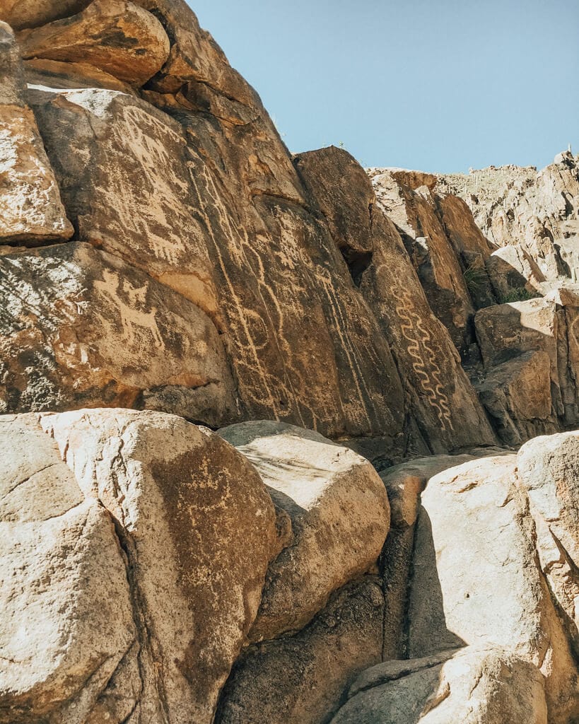
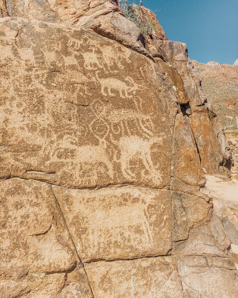
#6 Hieroglyphic Trail
The Hieroglyphic Trail is a fantastic hike in the Superstition Mountains that will lead you to historic hieroglyphics. It’s really unlike any other hikes in the area! This 2.9-mile round-trip trail also features a seasonal waterfall you can enjoy.
- Trailhead: 33.3901774,-111.4336781
- Mileage: 2.9 miles round trip
- Difficulty: Easy to moderate
- Elevation gain: 564 feet
- Parking permit: None
Starting at the Hieroglyphic Trailhead, the trail leads you through a scenic desert landscape dotted with saguaros, ocotillos, and cholla cacti. As you meander along the well-marked path, enjoy the stunning views of the surrounding Superstition Mountains and watch for local wildlife.
Upon reaching the trail’s end, you’ll discover a series of captivating petroglyphs etched into the rock face by the ancient Hohokam people. These ancient symbols offer a glimpse into the area’s rich history and cultural heritage.
During the rainy season, a seasonal waterfall cascades nearby, creating a picturesque oasis contrasting with the surrounding desert.
No parking permit is required at the Hieroglyphic Trailhead, which offers limited parking and no restroom facilities.
Read Next: Sedona’s Most Popular Vortexes Ranked Best to Worst
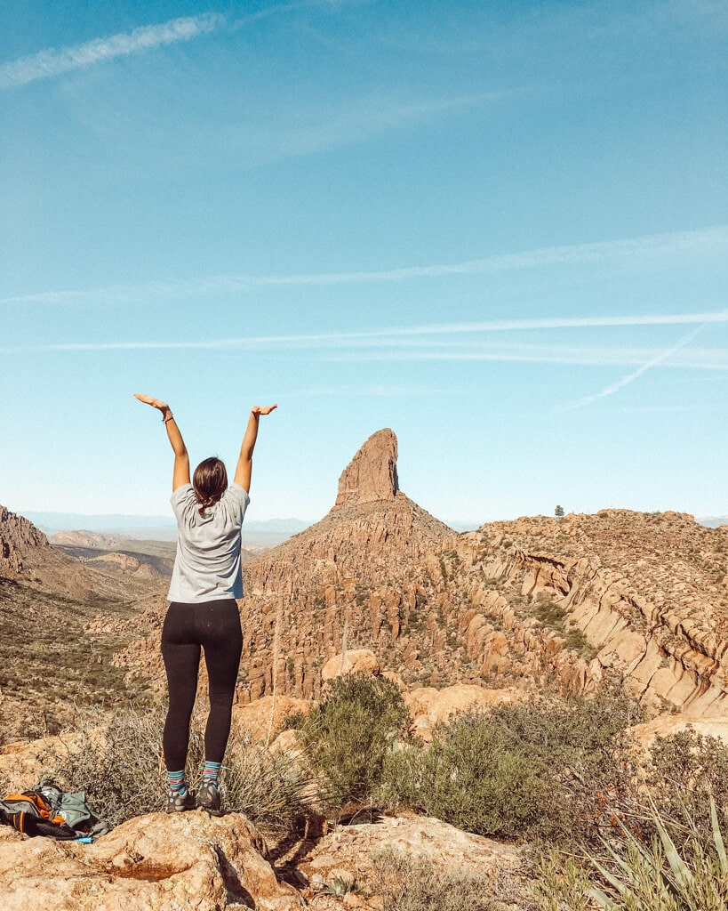
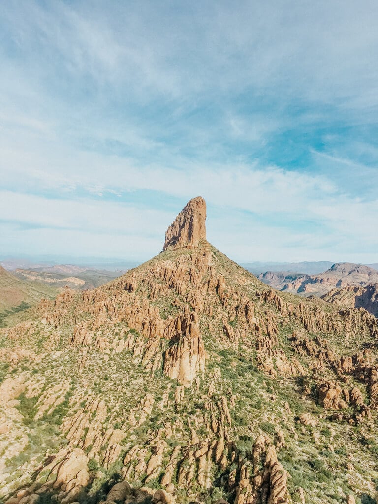
#7 Weaver’s Needle Loop
Weaver’s Needle Loop presents an awe-inspiring, demanding hike in the Superstition Mountains, guiding you on a 12.5-mile odyssey through varied terrains while showcasing spectacular vistas and an intimate encounter with the iconic Weaver’s Needle rock formation. This formidable trail caters to seasoned hikers yearning for a full-day adventure that leaves a lasting impact— bring your Sony a6400 to take incredible photos!
- Trailhead: 33.3973514,-111.3505266
- Mileage: 12.5 miles round trip
- Difficulty: Strenuous
- Elevation gain: 2,814 feet
- Parking permit: None
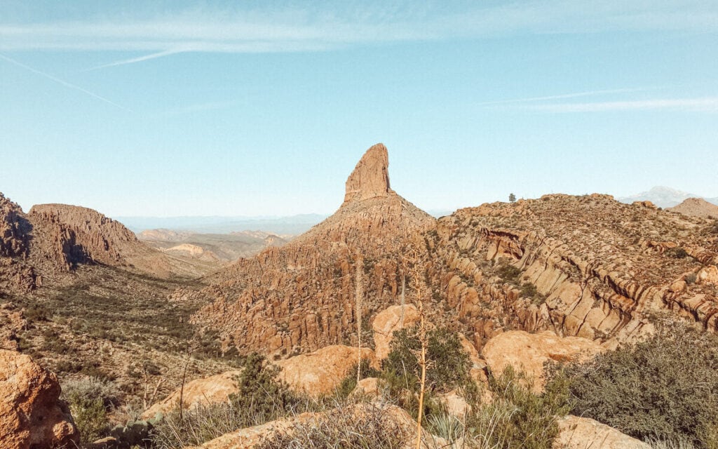
Starting at the Peralta Trailhead, the loop trail leads you through a stunning desert landscape before entering a canyon filled with lush vegetation. As you ascend the Peralta Canyon, you’ll enjoy breathtaking views of the surrounding mountains, including the distinctive Weaver’s Needle.
Continuing along the trail, you’ll pass by Fremont Saddle, a picturesque viewpoint offering panoramic vistas of the surrounding wilderness. The trail then descends into Boulder Canyon, where you’ll encounter a challenging, rocky terrain that requires careful navigation.
As you complete the loop, the trail reconnects with the Peralta Trail, leading you back to the trailhead.
P.S. You might also like my blog on easy hikes in Sedona, AZ!
#8 Fremont Saddle Peralta Canyon Trail (Popular Hike in the Superstition Mountains)
If you lookup anything about the Supers, you’ll probably see mention of this trail. As an Arizona local, I can attest to how great Peralta is! The Peralta Trail is a moderate hike in the Superstition Mountains and probably one of the most popular ones in the area—for good reason too. This 4.6-mile round-trip trail leads you through a picturesque desert landscape. You’ll see the iconic viewpoint at Fremont Saddle overlooking the iconic Weaver’s Needle.
- Trailhead: 33.3973514,-111.3505266
- Mileage: 4.6 miles round trip
- Difficulty: Moderate
- Elevation gain: 1,341 feet
- Parking permit: None
Starting at the Peralta Trailhead, the well-marked trail takes you through a scenic desert filled with saguaros, cholla cacti, and diverse vegetation.
As you gradually ascend through the Peralta Canyon, the trail offers increasingly stunning views of the surrounding Superstition Mountains.
Upon reaching Fremont Saddle, hikers are rewarded with a breathtaking panoramic view of Weaver’s Needle and the rugged wilderness beyond!
This picturesque spot is an ideal location to rest, take photos, and soak in the beauty of the Superstition Mountains before beginning your descent back to the trailhead.
Pro Tip: Wear sunscreen! This trail has just about no shade.
#9 Battleship Mountain Scramble
Battleship Mountain is one of the more challenging hikes in the Superstition Mountains, popular for its difficult terrain. Experienced hikers looking to explore the rugged beauty of the wilderness will enjoy this trail. This 11.3-mile round-trip trail takes you through varied terrain, including canyons, rocky ridges, and dense vegetation, culminating in stunning panoramic views from the summit.
- Trailhead: 33.4804833,-111.4630608
- Mileage: 11.3 miles round trip
- Difficulty: Strenuous
- Elevation gain: 1,847 feet
- Parking permit: None
The hike begins at the First Water Trailhead, leading you through a picturesque desert landscape before entering a lush canyon filled with diverse flora.
Bring your Sony a6400 for some pictures! As you traverse the trail, you’ll encounter a series of creek crossings and rocky ascents that require careful navigation and occasional scrambling.
As you approach the summit, the trail becomes steeper and more rugged, offering a thrilling challenge for experienced hikers.
Once atop Battleship Mountain, you’ll be rewarded with breathtaking views of the Superstition Mountains, Weaver’s Needle, and the surrounding wilderness.
Pro Tip: This trail is rocky and challenging so wear good hiking boots to stay safe.
#10 Garden Valley Loop
The Garden Valley Loop (AKA Second Water and Hackberry Spring Loop) is a delightful and moderate hike in the Superstition Mountains, perfect for hikers of all skill levels and families seeking a leisurely adventure. This 5.5-mile loop trail offers a blend of beautiful desert landscapes, fascinating rock formations, and a glimpse of the area’s unique flora and fauna. Warning: the trail can be difficult to follow at times.
- Trailhead: 33.4599116,-111.4403933
- Mileage: 5.0 miles round trip
- Difficulty: Easy to moderate
- Elevation gain: 570 feet
- Parking permit: None
Starting at the First Water Trailhead, the trail leads you through the scenic desert landscape, where you’ll encounter a variety of cacti, wildflowers, and native plants.
As you continue through the Garden Valley, you’ll be treated to relatively flat terrain, making this hike suitable for beginners and experienced hikers.
Watch for local wildlife, such as lizards, rabbits, and various bird species, as you traverse the picturesque valley!
#11 Carney Springs Waterfall via Lost Goldmine Trail
See water in Arizona! The Carney Springs Trail and Lost Goldmine Trail is a moderately challenging hike in the Superstition Mountains, ideal for hikers looking to explore the area’s diverse terrain and stunning vistas. It’s a great hike to do after a heavy rainfall because you’ll get to see a natural waterfall.
- Trailhead: 33.3856582,-111.3630557
- Mileage: 4.2 miles round trip
- Difficulty: Moderate
- Elevation gain: 633 feet
- Parking permit: None
The hike starts at the Carney Springs Trailhead, leading you through a scenic desert landscape filled with cacti and desert vegetation.
After reaching the junction with the Lost Goldmine Trail, you’ll follow the trail as it skirts the base of the Superstition Mountains, providing a unique perspective on the area’s striking geological features.
No parking permit is required at the Carney Springs Trailhead, which offers limited parking and no restroom facilities.
#12 Massacre Falls Trail
Massacre Falls Trail is one of the best hikes in the Superstition Mountains that have a natural waterfall! The waterfall is seasonal and surrounded by some of the most beautiful cactus-covered landscapes! I recommend hiking this trail after a rainy day. When not flowing, you can climb right up to the falls too — can you spot me in the second picture?
- Trailhead: 33.4715295,-111.4716582
- Mileage: 5.4 miles round trip
- Difficulty: Moderate
- Elevation gain: 1,092 feet
- Parking permit: None
Starting at the Crosscut Trailhead, the trail leads you through a scenic desert environment filled with saguaros, cholla cacti, and various desert flora. As you make your way along the trail, enjoy stunning views of the surrounding Superstition Mountains and keep an eye out for local wildlife.
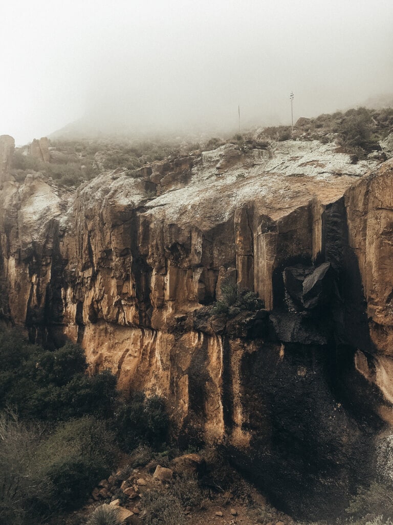
The trail gradually ascends, requiring some rocky scrambles and careful footing as you approach the falls. Massacre Falls is a seasonal waterfall, so plan your hike after a rainy period to increase your chances of witnessing its full splendor.
When flowing, the falls create a tranquil oasis, contrasting beautifully with the rugged desert surroundings.
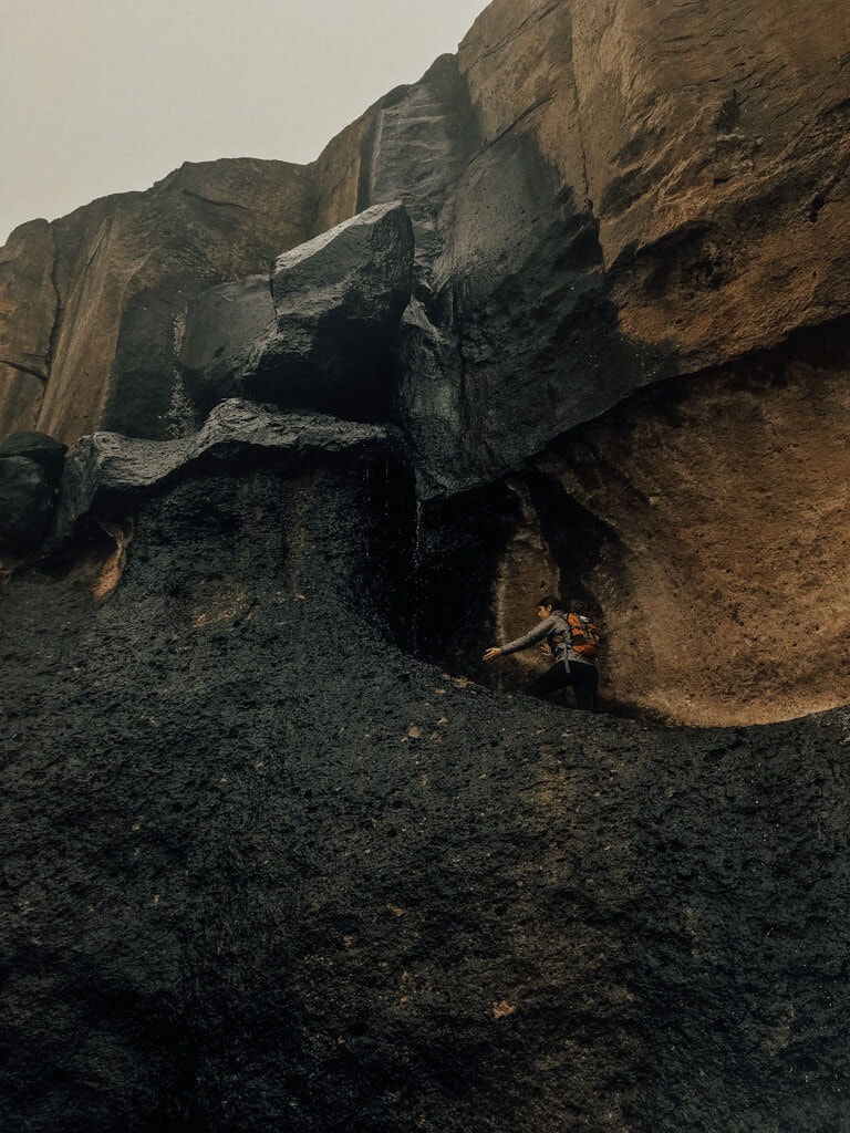
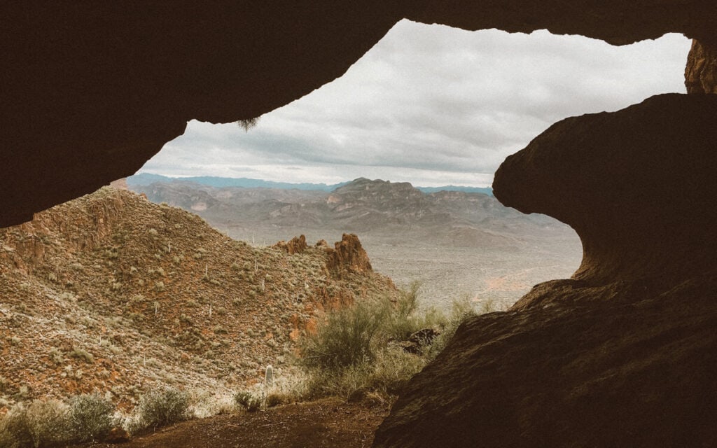
#13 Broadway Cave via Jacob’s Trail
Are you ready for a unique adventure? Broadway Cave is one of the best hikes in the Superstition Mountains and lucky for you, it’s easy to get to! For a majority of your hike, you’ll navigate through flat and open desert, so make sure you wear sunscreen and a hat.
- Trailhead: 33.4078598,-111.4789771
- Mileage: 4.3 miles round trip
- Difficulty: Easy to moderate
- Elevation gain: 977 feet
- Parking permit: None
Starting at the Broadway Trailhead, the trail leads you through the desert — truthfully when I hiked this trail, I didn’t like the views that much, BUT they get much better once you’re in the cave!.
As you hike along the well-marked path, enjoy the stunning views of the surrounding Superstition Mountains and watch for local wildlife such as lizards, rabbits, and various bird species. This area is known as Monument Canyon.
The trail gradually ascends towards the base of the mountain, where you’ll find the entrance to Broadway Cave.
This large, shallow cave offers a fascinating geological feature to explore, as well as a shaded spot to rest and enjoy the panoramic views of the valley below.
#14 Picketpost Mountain Trail
Are you up for a thrilling and rewarding challenge? The Picketpost Mountain Trail is a difficult trail but one of the best hikes around the Superstition Mountains. It’s actually outside the mountain range, but worth the view if you want a unique adventure. This 4-mile round-trip trail takes you through a striking desert landscape, culminating in a summit with breathtaking panoramic views of the surrounding area. It’s known for the mailbox at the top!
- Trailhead: 33.272392,-111.1790747
- Mileage: 4 miles round trip
- Difficulty: Difficult
- Elevation gain: 1,900 feet
- Parking permit: Required
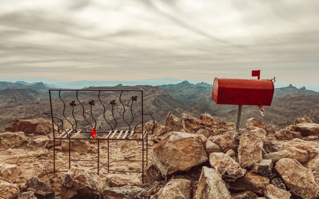
Starting at the Picketpost Trailhead, the trail leads you through a beautiful desert environment filled with saguaros, cholla cacti, and a variety of desert flora. As you make your way along the well-marked path, enjoy the captivating views of the Superstition Mountains and the diverse terrain.
The trail becomes progressively steeper and more challenging as you approach the summit, requiring some scrambling and careful footing.
Once you reach the top, you’ll be rewarded with spectacular 360-degree views of the surrounding landscape, including the distant mountain ranges and the vast desert below!
What to Pack for Your Superstitions Adventure
Now that you known what hikes you’ll be on, make sure you bring these items with you!

Keen Targhees

Trekking Poles

Hydroflask

Hat

Osprey Pack

Sunscreen
Keen Targhees
Trekking Poles
Hydroflask
Hat
Osprey Pack
Sunscreen
Frequently Asked Questions About Hiking the Superstition Mountains
What is the hardest hike in the Superstition Mountains?
The hardest hike in the Superstition Mountains is considered to be the Flat Iron Trail via Siphon Draw. This challenging hike is 5.5 miles round trip and features an elevation gain of approximately 2,800 feet.
The trail involves steep inclines, rocky scrambles, and some sections that require using your hands for climbing. The difficulty and technical aspects of the Flat Iron Trail make it the most strenuous hike in the Superstition Mountains. However, for experienced and well-prepared hikers, the stunning views from the summit make it a worthwhile endeavor.
What is the easiest trail in the Superstition Mountains?
The easiest trail in the Superstition Mountains is the Discovery Trail. This trail is approximately 0.5 miles long and is wheelchair accessible. It is a relatively flat and easy hike that offers an excellent opportunity to experience the desert landscape and the stunning views of the Superstition Mountains.
The Discovery Trail is also ideal for families with young children, as it provides an opportunity for an enjoyable outing without requiring much physical exertion. Despite being the easiest trail, the Discovery Trail still offers an impressive display of the natural beauty of the Superstition Mountains, making it a great starting point for hikers and visitors of all ages and abilities.
What is the best time of year to hike the Superstition Mountains?
The best time of year to hike the Superstition Mountains is during the fall, winter, and spring months, specifically from October to April. During this time, temperatures are typically cooler, ranging from the mid-60s to mid-70s Fahrenheit, making it more comfortable for hikers to enjoy the trails without the extreme heat of the summer months. The cooler temperatures also make for more enjoyable and safer hiking conditions.
From May to September, temperatures can reach well over 100 degrees Fahrenheit during the summer months, creating hazardous hiking conditions for even the most experienced hikers.
I recommend you avoid hiking during the summer months and instead explore the Superstition Mountains during the cooler months when conditions are more favorable. It’s important to always check the weather forecast before hiking and to bring plenty of water and sun protection regardless of the time of year.
Final Thoughts on the Best Hikes in the Superstition Mountains, AZ
With each hike boasting its own unique features and challenges, there’s no doubt that the Superstition Mountains offer some of the most rewarding trails in the Southwest. Whether you’re a seasoned hiker or just starting out, this diverse range of trails caters to all abilities and interests.
If you’re exploring more of Arizona, check out my other posts on the area!
