
")


")
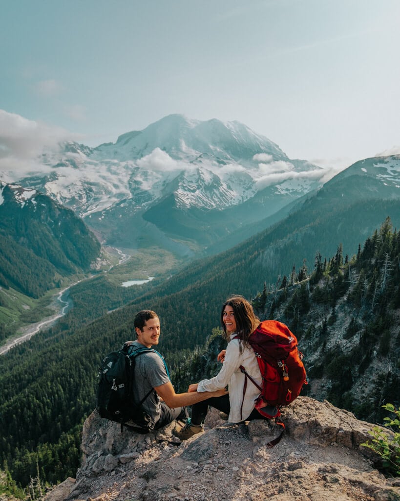
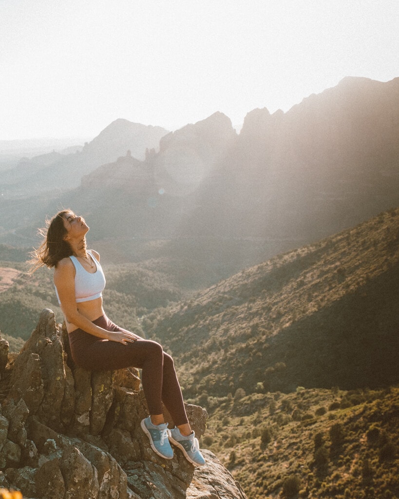
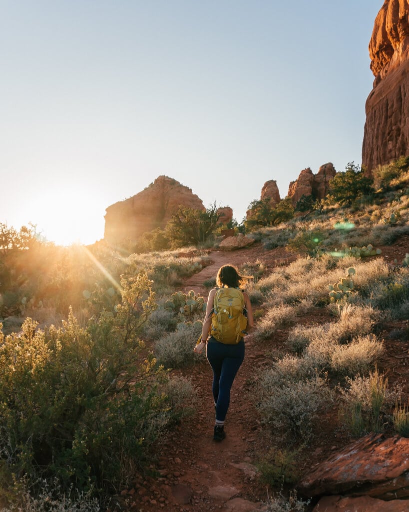
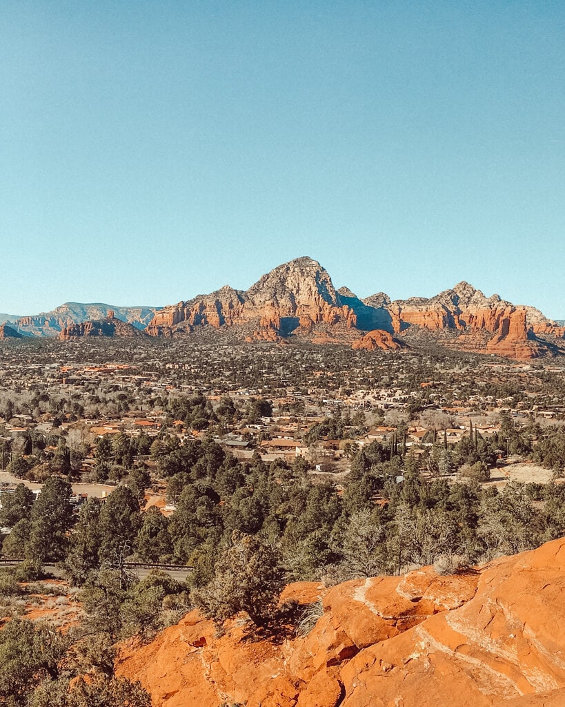
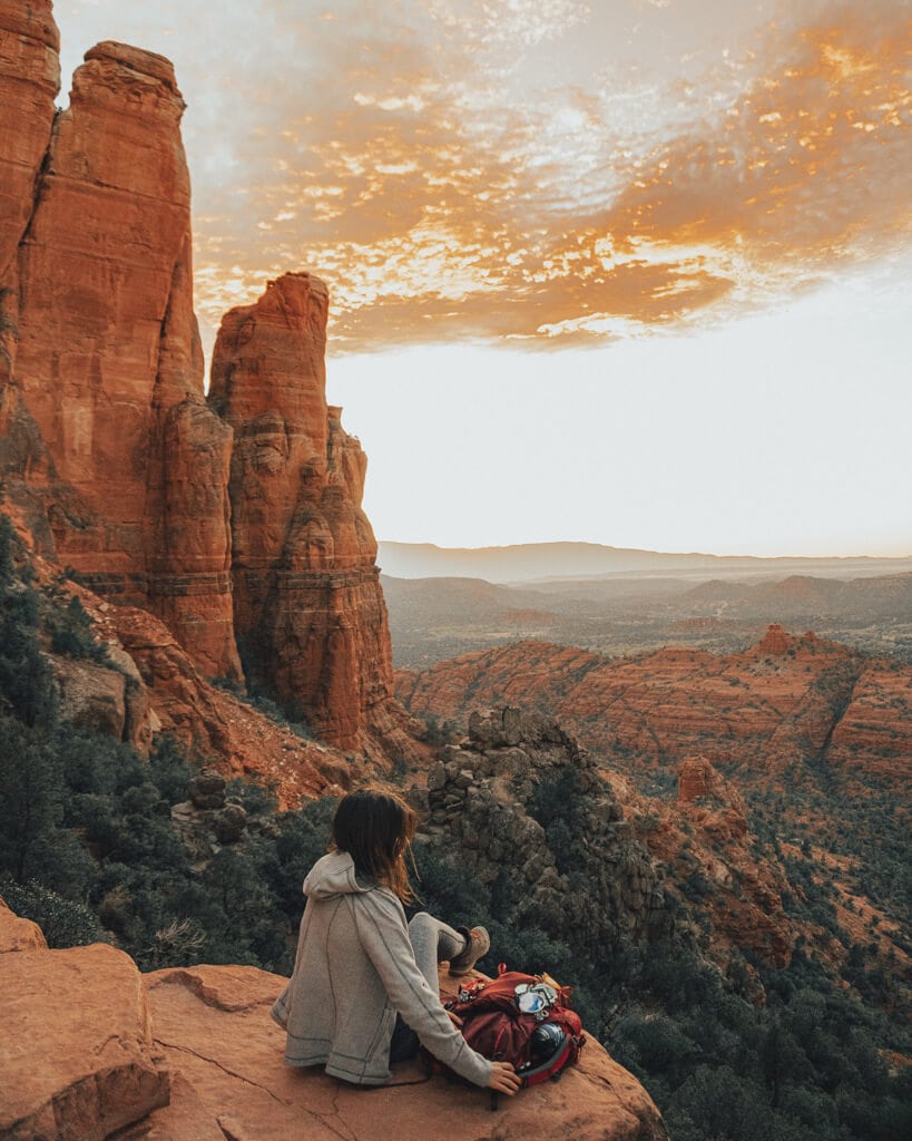
Sedona, Arizona, is an oasis for photographers, hikers, and explorers, full of vortexes, red rocks, and adventures. But you know what’s really amazing? Sedona sunsets and sunrises!
As a hiker’s heaven, there are TONS of trails to explore (from difficult to easy Sedona hikes), but not all are ideal for sunset and sunrise. So let’s clear up what are the best Sedona sunset and sunrise hikes.
After you read this blog, check out these other posts that’ll help you plan the perfect Sedona vacation:
Before we begin, we need to cover two must-know Sedona details.
📌 Save this to Pinterest!

FREE CLASS: Get PAID to Travel!
Sign up for my free class and learn how I land paid brand deals that pay me to travel as a content creator and influencer!
Short on time and trying to plan a trip to Sedona? Book your stay at Enchantment Resort (luxury stay) or Desert Quail Inn (budget-friendly stay)!
What to Know Before Hiking in Sedona fro Sunrise & Sunset
Red Rock Passes
Most Sedona hiking trails require a Red Rock Pass, which you can purchase for $5 online or in-person at trailhead parking lots.
The Forest Service created the Red Rock Pass program to help keep Sedona trails as immaculate as possible. If you skip on buying a pass and displaying it on your dash, you can get a citation – that’s no fun!
Avoid the Pass: If you’re a national park lover and have your America the Beautiful Interagency Pass handy, you can hang that on your car and you’ll be good to go! Read my guide on this here!
Sedona Shuttle System
To help with parking and provide more trail access to visitors, Sedona recently created a free shuttle system that runs Thursday through Sunday year round.
It provides transportation to Dry Creek (for Devil’s Bridge), Cathedral Rock Trail, and Solider Pass, which means you may not be able to park in these lots during service hours.
Being new, the shuttles still have kinks to work out (running 30+ minutes late, etc.), so plan your trip accordingly. You can read more about the system on my Sedona travel guide. Let’s get into the best sunset and sunrise hikes in Sedona, shall we?
✨ PS: You might need these! Sturdy hiking boots, a cute sun hat, a headlamp, sunscreen, a reusable water bottle, and sunglasses.
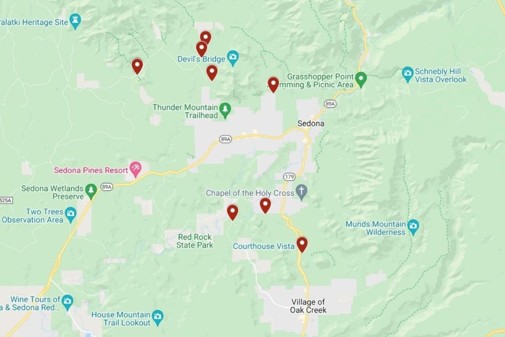
List of Best Sedona Sunset & Sunrise Hikes + Map
- Cathedral Rock (Sunset)
- Red Rock Crossing (Sunset)
- Devil’s Bridge via Chuck Wagon Trail (Sunrise)
- Bear Mountain (Sunrise)
- Soldier Pass (Sunrise)
- Bell Rock via Bell Rock Access Trail (Sunset)
- Birthing Cave via Long Canyon Trail (Sunrise)
- Doe Mountain (Sunrise)
- Airport Mesa Vortex (Sunset)
- Sugarloaf Mountain via Teacup Trail (Sunrise)
- Munds Wagon Trail (Sunset)
Click here to access a live version of the map!
Best Sedona Hikes for Sunset and Sunrise
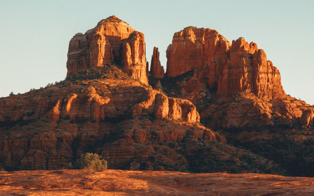
#1 Cathedral Rock (Sunset)
If you’ve never been to Sedona, hiking Cathedral Rock vortex is a must.
- Cathedral Rock Trailhead: 34.8251648,-111.7895865
- Difficulty: Moderate
- Distance: 1.4 miles round trip (out and back)
- Time to Top: 30 minutes to an hour
- Elevation Gain: 645 feet
- Red Rock Pass Required? Yes or America the Beautiful Pass
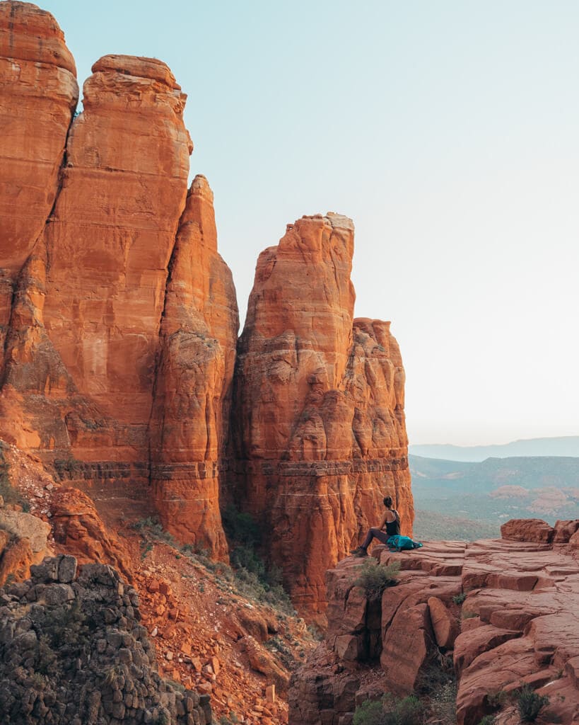
Cathedral Rock is the iconic landmark you’ve probably seen in most pictures of Sedona.
It is GORGEOUS at sunset, so you’ll want to have your camera gear ready!
Due to its popularity and the markers, the path is relatively easy to navigate, even after the sun goes down. You’ll want to get to Cathedral Rock Trail off Back O’ Beyond Road to start your hike.
To get to the top, follow the trail markers— wear good hiking boots.
Cathedral Rock Trail climbs gradually, but will definitely test your fitness level, especially during the scramble section.
The scrambling section is near the halfway point.
That scares most people, but folks of all shapes and sizes can make it up — take your time!
From there, it’s a straight shot to the “End of Trail” sign at the top.
At the top, make sure you head left to find the hidden vortex pillar.
Trail Secret: Parking fills up quickly, so get here early for sunset— the “Edge” is where you can take some of the best pictures.
#2 Red Rock Crossing via Verde Valley Road (Sunset)
Red Rock Crossing is the perfect place to enjoy a Sedona sunset over Cathedral Rock, minus the strenuous hike!
- Baldwin Trailhead: 34.8217445,-111.8080694
- Difficulty: Easy
- Distance: 1.4 miles round trip (out and back)
- Time to Crossing: 10 to 20 minutes
- Elevation Gain: 50 feet
- Red Rock Pass Required? Yes or America the Beautiful Pass
Below, I’ll talk about a couple of ways to get there (check the “Trail Secret” for my preferred way!). Park at the Baldwin Trailhead to start your hike.
Beware that there are only about 15 spaces at the trailhead!
Once parked, hang a left down Verde Valley Road until you get to Oak Creek.
From here, swing a right and walk along Red Rock Crossing Trail for 0.5 miles to Templeton Trail.
Take Templeton 0.2 miles to Buddha Beach where you can go swimming (bring a swimsuit and hiking sandals).
And voila! You’ve arrived.
With the Crossing’s proximity to Cathedral Rock, you’ll have incredible close and personal views of this Sedona landmark for sunset!
Trail Secret: To avoid having to navigate the creek and trails, go to Crescent Moon Day Use Site and follow the paved path here — especially perfect if you only have one day in Sedona!
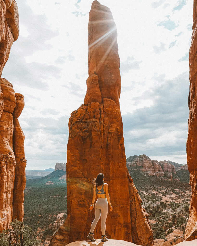
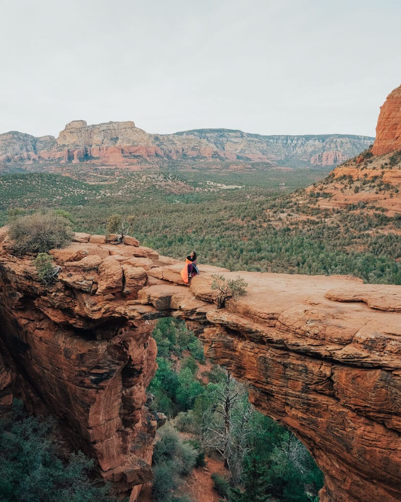
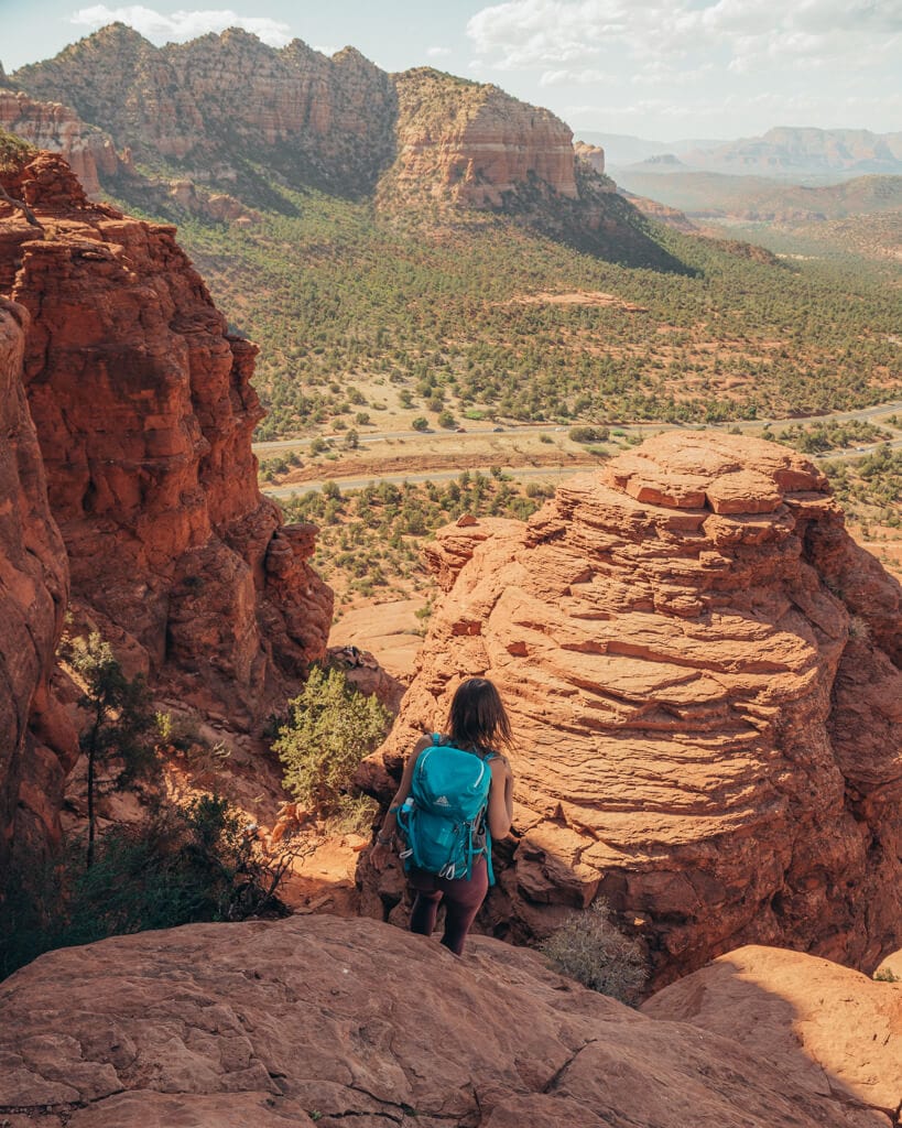
#3 Devil’s Bridge via Chuck Wagon Trail (Sunrise)
Devil’s Bridge glitters with the prettiest golden color in the morning, making it one of the best Sedona hikes for sunrise.
- Chuck Wagon Trailhead: 34.8908909,-111.8215838
- Difficulty: Moderate
- Distance: ~6 miles round trip (out and back)
- Time to Bridge: 1 to 1.5 hours
- Elevation Gain: 400 feet
- Red Rock Pass Required? Yes or America the Beautiful Pass
Unfortunately, getting to Devil’s Bridge via Chuck Wagon Trail includes a trail junction that can confuse people, so let’s get into what to expect!
Park at the Chuck Wagon Trailhead lot off Boynton Pass Road to start your adventure.
Once parked, hike Chuck Wagon for about 2 miles to the Devil’s Bridge Trail junction.
The entire route before the junction is relatively flat and easy to follow.
Once you hit Devil’s Bridge Trail, things start to pick up since all the elevation gain is along this path— wear sturdy hiking boots.
BUT, it’ll be a straight one-mile shot to Devil’s Bridge from here!
Will you be brave enough to cross the Bridge when you get there?
Ooooooooooo, spoooookyyyyyy.
Trail Secret: Drive a 4×4, high-clearance vehicle directly to Devil’s Bridge Trail for a shorter hike or click here to book a Jeep Tour!
#4 Bear Mountain Trail (Sunrise)
Bear Mountain Trail is more on the strenuous side of all the sunrise hiking trails in Sedona, AZ.
- Bear Mountain Trailhead: 34.8983127,-111.874322
- Difficulty: Difficult
- Distance: ~5 miles round trip (out and back)
- Time to Top: About 1.5 to 2 hours
- Elevation Gain: 1,800 feet
- Red Rock Pass Required? Yes or America the Beautiful Pass
You’ll park at the Doe Mountain parking lot and cross the street to the Bear Mountain Trailhead to begin your journey.
The trail starts flat but quickly begins to climb up to the summit.
Sometimes the path to the summit becomes faint and may be difficult for you to follow, especially for sunrise!
But if you keep your eyes peeled for white diamonds painted on the trail, you will have no problem making it to the top.
Bring a headlamp if you’re doing this for sunrise.
At Bear Mountain Summit, you’ll see one of Sedona’s best panoramic sunrise views and, if you’re lucky, hot air balloons!
Hot air balloons and golden light make for a dreamy morning!
Trail Secret: If you want to hike this for sunrise, consider allocating 2 hours to reach the summit or just book a Sedona sunrise hot air balloon tour!
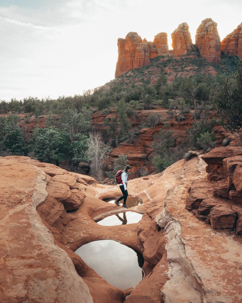
#5 Soldier Pass Trail via Cibola Pass (Sunrise)
Caves and pools and sinkholes, oh my! Soldier Pass trail happens to have all of those, making it an enjoyable Sedona hike for your next sunrise.
- Jordan Road Trailhead: 34.8879751,-111.7684405
- Difficulty: Easy to Moderate
- Distance: ~2.8 miles round trip to Pools (out and back)
- Time to Pools: About 30 minutes
- Elevation Gain: 170 feet
- Red Rock Pass Required? Yes or America the Beautiful Pass
Since the Soldier Pass Trailhead parking lot opens at 8 AM, you will have to begin your sunrise mission from the Jordan Road parking lot (also referred to as Jim Thompson).
Once parked, hop on Cibola Pass Trail.
You’ll hike 0.7 miles to connect with Jordan Trail, then another 0.3 miles to get on Soldier Pass Trail.
At this point, you’ll see the famous Devil’s Kitchen Sinkhole!
You’ll come up to the famous Seven Sacred Pools in about 0.4 miles, and if you keep going you can hunt for the Soldier Pass Cave.
The Pools are best enjoyed after a rainfall.
About 0.9 miles away from the Pools, there will be a fork in the trail.
Taking the right side will lead you up to an open mesa. In the distance, you’ll see a red rock wall — this is where the Cave is!
The trail to the Cave will be along the lefthand side of the mesa.
Trail Secret: Getting to the Secret Cave requires some scrambling, so save it for after sunrise! It’s a great Sedona photo spot so bring your travel camera gear with you.
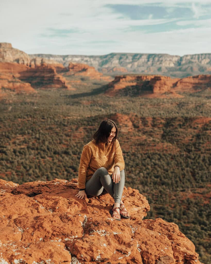
#6 Bell Rock Climb via Bell Rock Access Trail (Sunset)
The Bell Rock Vortex is iconic for its Bell shape, but not many folks known you can explore the top of it!
- Bell Rock Trailhead: 34.8050676,-111.7667896
- Difficulty: Moderate
- Distance: 0.8 miles round trip
- Time to Top: 45 minutes to an hour
- Elevation Gain: 600 feet
- Red Rock Pass Required? Yes or America the Beautiful Pass
Various trails lead you around the rock, but the top is where the real magic happens.
You can begin your hike from two different parking lots, but for the quickest route, start from the Courthouse Vista lot.
On some maps, it is labeled as the “Bell Rock Trailhead.”
From the Courthouse Vista lot, jump onto Bell Rock Access Trail.
It will have wooden signs leading to the Bell Rock Climb, which is the path you’ll take to the top!
The trail will start flat but will ascend rather quickly as you begin your climb.
At the top, you’ll have a great place to watch the sunset (but there is no shade so wear sunscreen)!
The Bell Rock Climb isn’t for the faint of heart, but completing it will give you panoramic red rock views, making this one of the best Sedona sunset hikes!
Trail Secret: If you’re afraid of heights, this trail may be difficult for you when the sun goes down, so as an alternative, do the Courthouse Butte and Bell Rock Loop (3.9 miles RT).
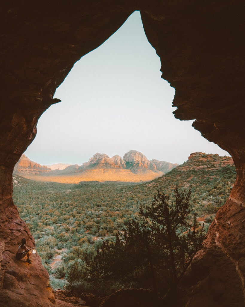
#7 Birthing Cave via Long Canyon Trail (Sunrise)
Known for having sacred powers and teardrop shape, the Birthing Cave is a Sedona local favorite and just so happens to look fabulous at sunrise.
- Long Canyon Trailhead: 34°54’24.0″N 111°49’27.5″W
- Difficulty: Easy
- Distance: 1.5 miles round trip
- Time to Cave: About 15 minutes
- Elevation Gain: ~400ft
- Red Rock Pass required? No
Your hike to Birthing Cave will begin on Long Canyon Trailhead No. 122.
Parking is limited, so plan to get here early!
You will find that the trail is flat and wide with no elevation gain.
Hike for about 0.6 miles until you reach a fork—go left towards the red cliffs!
You should be able to see the Cave nestled in the red rocks ahead.
As you get closer to the Birthing Cave, keep an eye out for a small trail that will lead directly to it.
The trail is steep and will require you to bushwack a bit, but it is less than a mile — wear a long sleeve shirt for protection.
Once inside, enjoy the view!
Women from all around come to the Birthing Cave hoping that it will give them a better chance at having a healthy pregnancy, so be respectful!
Trail Secret: To capture the best images, bring a 16-35mm f/4 and climb into the tiny hole in the center of the cave.
#8 Doe Mountain (Sunrise)
Hiking Doe Mountain doesn’t require much effort and its 360 perspective makes it a fantastic Sedona sunrise hike!
- Doe Mountain Trailhead: 34.8927633,-111.8651711
- Difficulty: Easy
- Distance: 1.7 miles round trip (out and back)
- Time to Top: 20 to 30 minutes
- Elevation Gain: 430ft
- Red Rock Pass Required? Yes or America the Beautiful
The trail begins at the Doe Mountain/ Bear Mountain parking area.
Almost immediately after you start your hike, you’ll reach the Aerie Trail junction.
Skip the junction and continue on the path forward to reach the top of Doe Mountain.
The trail itself is easy to follow and has a gradual incline.
A couple of well-made switchbacks will take you right to the mesa where you can enjoy sunrise!
Trail Secret: Doe Mountain is pretty great for sunset too, but the key is to get here well before your hike since parking is so limited.
#9 Airport Mesa Vortex (Sunset)
If you’ve been searching for places to watch the sunset in Sedona, you’ve undoubtedly come across Airport Mesa—for a good reason too!
- Airport Road Parking: 34.855304,-111.7803895
- Difficulty: Easy
- Distance: 0.1 miles round trip (out and back)
- Time to Vortex: 5 to 10 minutes
- Elevation Gain: Extremely minimal
- Red Rock Pass Required? No
The Airport Mesa Vortex is one of the most accessible Sedona vortexes and places to watch the sunset.
To reach the Mesa, park at the small lot off Airport Road and walk under 100 feet up a small path.
The vortex is less than 200 feet in front of you!
If you’re unsure of where exactly to go, ask folks in the area. It also sits high when it comes to ranking Sedona vortexes!
You’ll undoubtedly see some people climbing up a small rock formation lined with hand rails to help you reach the vortex.
Some maps refer to the precise path as Airport Mesa Trail while others call it Summit Trail.
Once you’re up there, though, you’ll have unobstructed panoramic views of Sedona— bring something like a Sony a6400 for great pics!
Trail Secret: As an alternative, you can do a ~1.2 mile round trip hike from the Sedona Airport Scenic Lookout parking lot, which costs $3 to park.
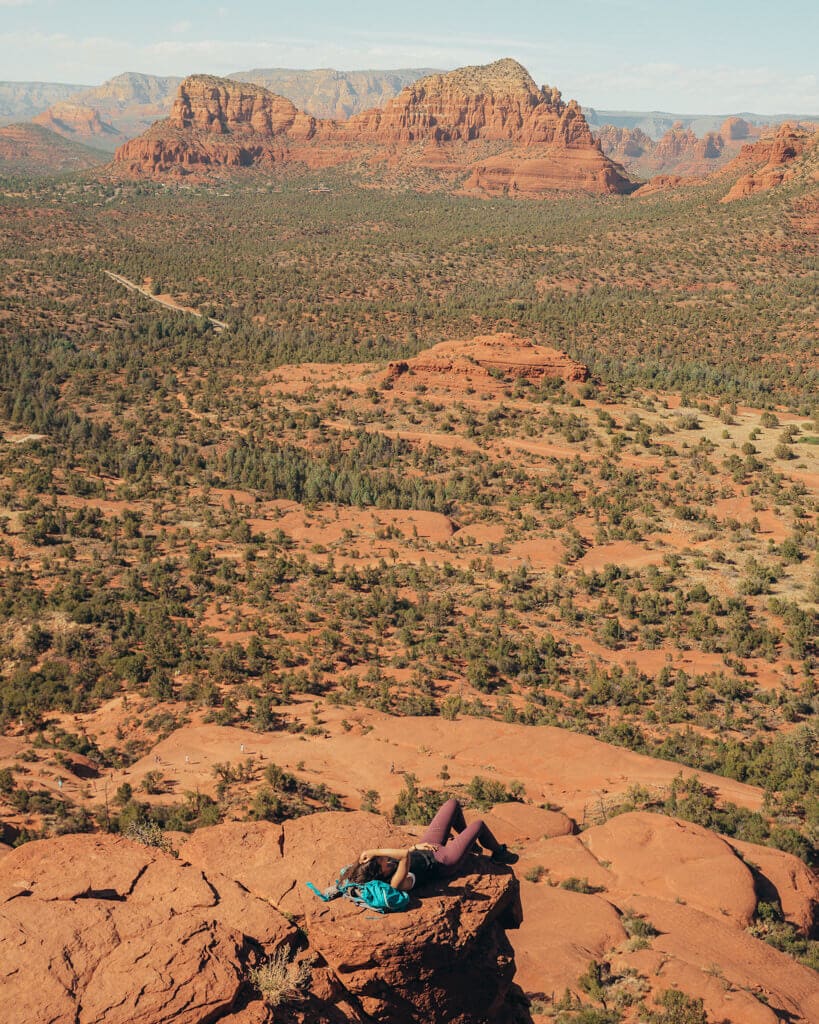
#10 Sugarloaf Mountain via Teacup Trail (Sunrise)
Sugarloaf Mountain towers over a valley of large Sedona red rock formations and makes for the perfect vantage point for a desert sunrise!
- Sugarloaf Trailhead: 34.8775908,-111.7969803
- Difficulty: Moderate
- Distance: 1.6 miles round trip (out and back)
- Time to Summit: 30 minutes to an hour
- Elevation Gain: 250 feet
- Red Rock Pass Required? Yes or America the Beautiful Pass
While hiking up a mountain for sunrise sounds intimidating, it’s pretty quick and easy to summit Sugarloaf!
Your adventure will start in the Sugarloaf Trailhead parking area.
From here, you’ll hop on Teacup Trail and hike a relatively flat 0.4 miles to Sugarloaf Loop Trail.
Stay on the left-most fork of Sugarloaf Loop, and walk 0.1 miles until you reach Sugarloaf Mountain Trail.
Hike Sugarloaf Mountain Trail 0.2 miles to the top of the mountain!
Your elevation gain will happen here, so take breaks as needed.
It can take some folks 30 minutes to an hour to reach the summit, so plan your sunrise mission accordingly!
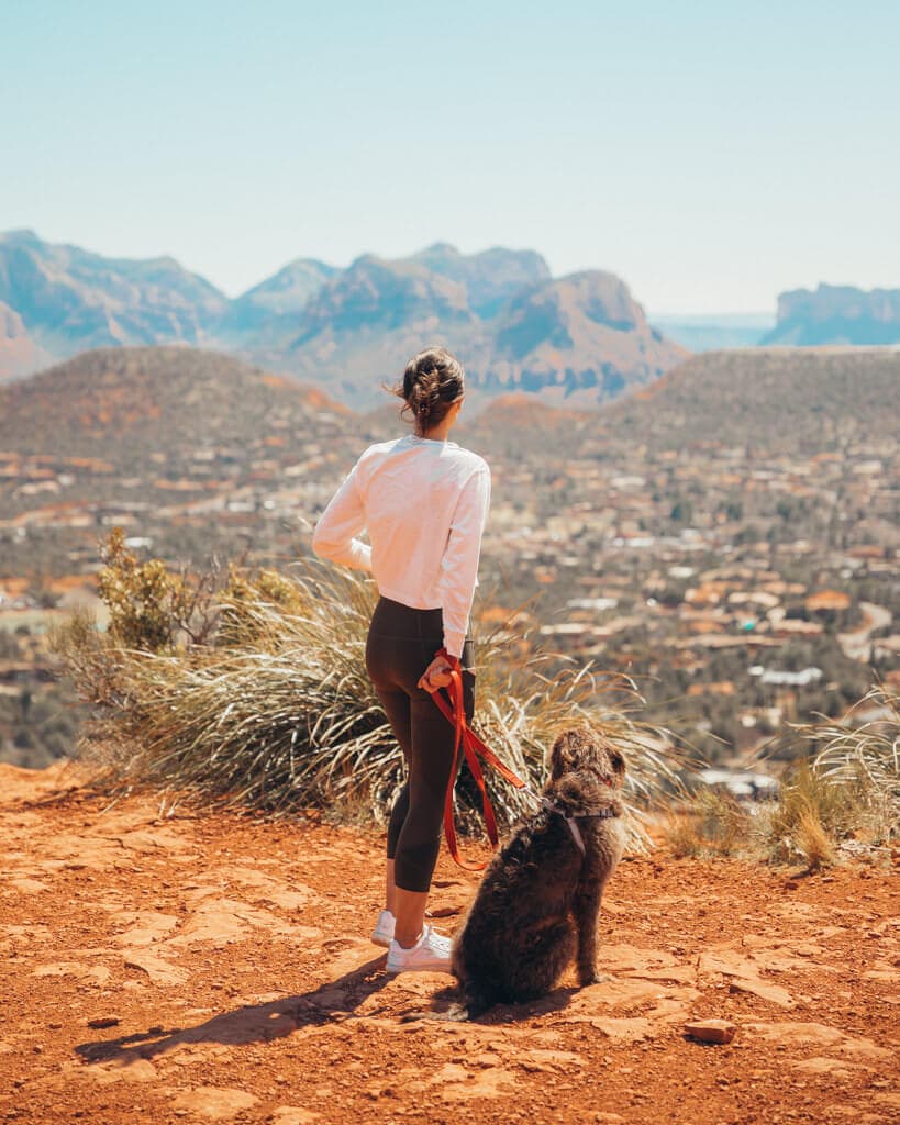
I loved bringing my dog here — Sedona is great like that because of the pet-friendly hotels and dog-friendly things to do!
Trail Secret: With its 360 views, Sugarloaf Summit can be the perfect hike for sunset too!
#11 Munds Wagon Trail to Merry Go Round Rock (Sunset)
Nestled in the heart of Sedona’s breathtaking Red Rock Country, the Munds Wagon Trail to Merry-Go-Round Rock offers hikers an unforgettable experience of Arizona’s natural beauty.
- Munds Wagon Trailhead Coordinates: 34.869034, -111.760251
- Difficulty: Moderate
- Distance: 6.4 miles round trip (out and back)
- Time to Complete: 2 to 3 hours
- Elevation Gain: Approximately 1,000 feet
- Red Rock Pass Required? No
You can expect to encounter ancient red rock formations, including the iconic Mitten Ridge, before reaching the stunning Merry-Go-Round Rock!
There’s even a secret little cave here— can you find it?
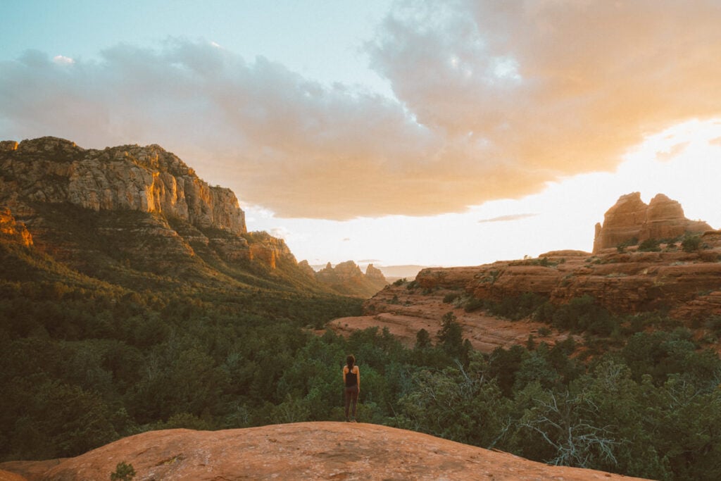
The trail is best enjoyed during sunrise or sunset when the sun’s rays paint the sandstone cliffs in vivid hues of orange and pink, creating a dramatic contrast with the surrounding scenery.
But from experience, sunset is my fave time to enjoy this hike!
And this was literally the best Sedona sunset I’ve ever seen.
Trail Secret: If hiking isn’t your thing, you can actually book an off-roading tour to get here!
More Amazing Sedona Hikes to Consider
Here are more hikes to consider!
Marg’s Draw (Sunset) — 2 miles round trip. Features rugged peaks and remarkable red rocks.
Fay Canyon Trail (Sunrise) — 2.4 miles round trip. You will see arches and sweeping views of Sedona!
Courthouse Butte Loop / Bell Rock Pathway (Sunset) — 3.9-mile loop. The loop will give you the best vantage points and sunset photo opportunities!
Boynton Canyon Trail (Sunset) — 6.1 miles round trip. This trail offers excellent vista views of Sedona and features a hidden cave!
My Top Picks for Sedona Hiking Trails
Based on my experience as an Arizona native, these are the Sedona hikes I would go on:
The Classics — Cathedral Rock and Devil’s Bridge are classics and you should highly consider doing these hikes if you’re a Sedona first-timer!
Unique Sunset Hike — I love Munds Wagon for sunset. While it’s not the easiest trail, it offers one of the most beautiful views in my opinion.
Easy Sunrise & Sunset Hikes — You can’t beat Doe Mountain as a Sedona sunrise hike and Red Rock Crossing is AMAZING for sunset!
Tips for Hiking Sedona During Sunset and Sunrise
Here are some things you need to keep in mind before you go and catch an epic sunset and sunrise in Sedona AZ!
Pay attention to the shuttle schedule — Watch the shuttle schedule if you’ll be in Sedona when the shuttles are running! You will NOT be able to access certain trailhead parking lots when the shuttles operate.
Watch the weather — If there are heavy clouds in the forecast, your chances of catching sunset or sunrise in Sedona, AZ, actually go down… quite a bit.
Space out your hikes — It’s tempting to visit and do every Sedona hiking trail! However, there are multiple things to see that make Sedona equally unique. If you need some inspo for your trip, check out my Sedona 3 day itinerary write-up.
Pack accordingly — Hiking in the desert is no joke, so come prepared:


Overall Thoughts on the Best Sedona Sunrise and Sunset Hikes
Sedona has some fantastic sunrise and sunset hikes! Hopefully, this list of trails helps you witness your share of cotton candy skies when you visit.
And if you’re planning an upcoming Sedona trip, read my other Sedona blogs:
- Best Budget Hotels in Sedona
- First-Timer’s Sedona, Arizona Travel Guide
- Most Instagrammable Places in Sedona
- Best Sedona Vacation Rentals
Happy hiking :)!
